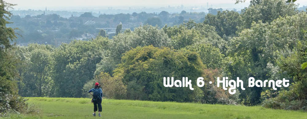
Walk No 6 - From High Barnet, at the northern end of the Northern Line, to Arnos Grove with a shorter option to Cockfosters.
|
Distance |
Full walk to Arnos Grove - 10.5 km (7 miles) Shorter Option to Cockfosters - 6.5 Km (4 miles) |
|
Underfoot |
Mostly paved surfaces but some woodland paths |
|
Outward Journey |
By Norther Line to High Barnet - about 30 minutes from Central London |
|
Return |
By Piccadilly Line from Cocfosters or Arnos Grove |
|
Points of Interest |
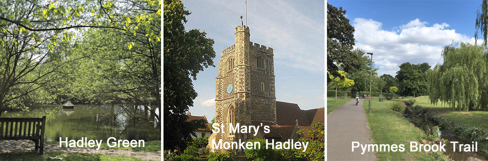
Hadley Green, Monken Hadley Common, Pymmes Brook |
|
Refreshments |
Cock Inn at Cockfosters |
|
Public Toilets |
At High Barnet Station |
|
Shortening the Walk |
Shorter option to Cockfosters as described |
What to Expect from This Walk
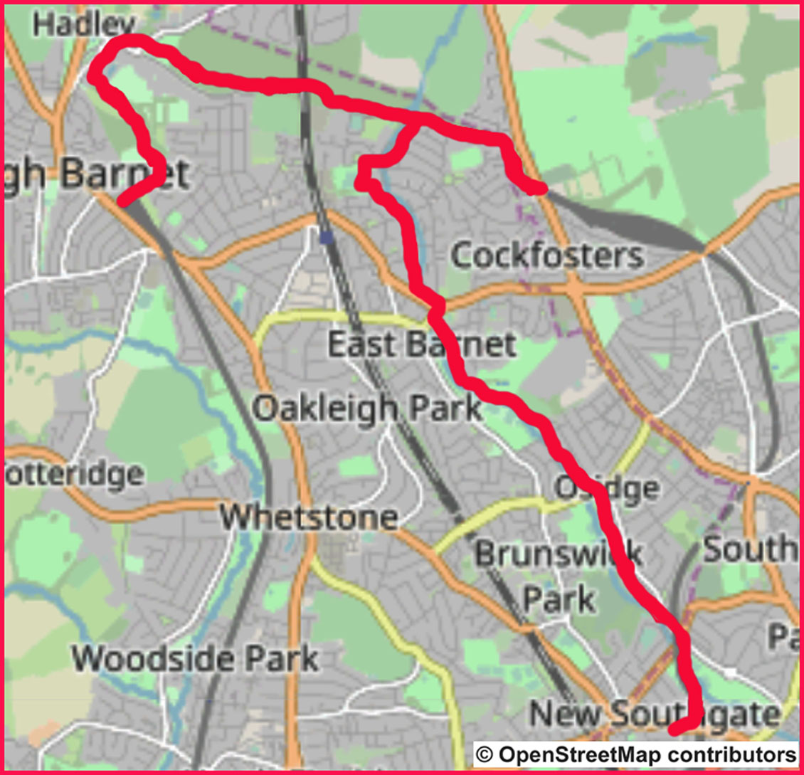
This walk starts at High Barnet Underground Station and ascends King George's Field with wonderful views over London. The route explores Hadley Green and Monken Hadley Common before crossing the main East Coast railway line between London and Scotland. You then descend to a junction with the Pymmes Brook Trail, where you have a choice between the full route to Arnos Grove Station or the shorter route to Cockfosters Station, both on the Piccadilly Line. Whichever you choose, you may wish to visit The Cock Inn (500m further on from the junction). If you choose the longer walk along the Pymmes Brook, there is 1.5 km of street walking before you regain the ribbon of parkland beside the brook.
1. Leave High Barnet Station by going up the pedestrian ramp and turning right into Meadway. Walk downhill for 650m and turn left into Burnside Close. At its end, follow a path to reach a London Loop sign, which you follow by turning left through a gate. Go ahead slightly uphill. After about 100m follow the path as it turns left and then descends to a sometimes muddy junction. Turn right and ascend King George’s Field. As you climb, be sure to stop to look behind you at the expanding views over London. At the top there is an information board.
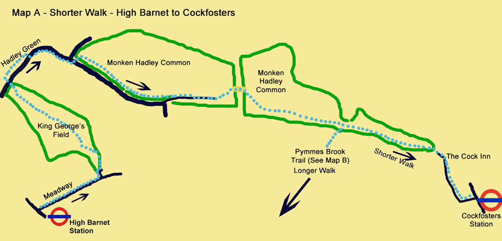
2. Cross Hadley Green Road and turn right to follow the perimeter of the Green. At its end, cross back over the road and follow the right-hand footway. The road swings right, with the church of St Mary the Virgin on your left. Shortly afterwards, you reach Monken Hadley Common. Cross over to the left-hand side of the road to continue in the same direction along the grass, staying close to the road. Enter the woods and follow a path which runs inside the woods parallel to the road.
3. After 500m you become aware that the noise of traffic has disappeared because the road has turned away from the woods. Emerge on a quiet drive which descends to a small car park. Go through the car park, swing left and then right to cross a bridge over the East Coast railway line. Continue ahead and descend through woods for about 400m to reach a signpost indicating that the Pymmes Brook Trail goes off to the right.
For the short walk (Map A) continue straight ahead at the signpost to reach the end of the woods. On leaving the woods, continue on a minor road to Cockfosters Station. Shortly after leaving the woods, you will pass The Cock Inn on your right.
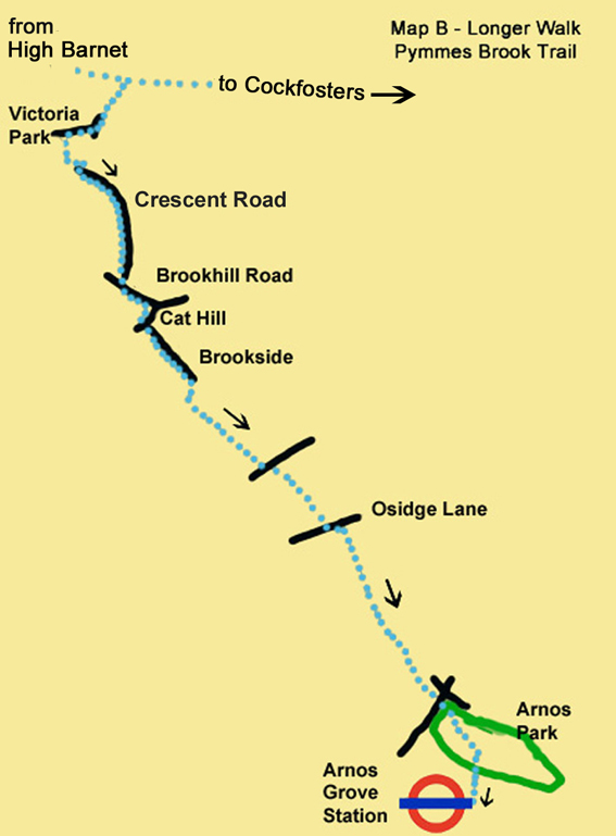
4. For the full walk (Map B) turn right at the signpost to join the Pymmes Brook Trail. Walk downhill beside the brook and immediately go under a bridge. Follow the path to reach a quiet suburban road. After 120m, turn right into Lawton Road. Follow the left-hand footway uphill beside a hedge. Take the second gap in the hedge to enter a small park and follow the path as it curves right and then left beside some tennis courts. At the end of the tennis courts turn left. You leave the park, still following the signs for the Pymmes Brook Trail.
5. Turn right and then left into Crescent Road, which you follow for about 700m. Turn left into Brookhill Road and right into Cat Hill. Descend Cat Hill and turn left into Brookside. Walk along the right-hand footway, with the Pymmes Brook in sight downhill across the grassy area to your right. Continue ahead for about 400m, after which you follow a path down to the brook. Turn left to walk alongside it.
6. After about 500m cross a road and continue walking over the grass on the left-hand bank of Pymmes Brook. After 300m cross another road and reach Osidge Lane. Cross over, turn left and then right to continue along a good path. After 1 km you emerge on another road beneath a railway viaduct. Cross under the viaduct and walk ahead into Arnos Park. Continue for 400m, passing two bridges over the brook. Take the third bridge to exit the park. Walk up Arnos Road to the main road and turn right to Arnos Grove Station. The Arnos Arms can be found at the top of Arnos Roa
Information on Things You Will See
King George's Fields is one of many identically named recreational areas all over the country, established as memorials to King George V who died in 1936. The site consists of a patchwork of fields, intersected by overgrown hedgerows, narrow strips of woodland and small streams. There are a number of magnificent old oaks, and breeding birds. The hill rises to approximately 130 metres and provides goods views southwards towards Hampstead Heath and Central London.
Monken Hadley Common is an area of fields and woodland, about 72 hectares in size, shaped like a wedge with its broad end half a mile wide at Monken Hadley and tapering to a point at Cockfosters. It is bisected by the main East Coast Railway Line. It was created as a common by an Act of Parliament in 1777. It is a site of importance for nature conservation and if you are very lucky you may see a muntjac deer which use the common for grazing.
Pymmes Brook Trail runs for 10 miles across north west London from Monken Hadley Common to the Lee Valley Leisure Complex at Edmonton. It is named after William Pymme a 14thC landowner. Jack’s Lake or Beech Hill Lake was formed by damming the brook. The brook uses a series of parks and pathways to create a recreational route.

