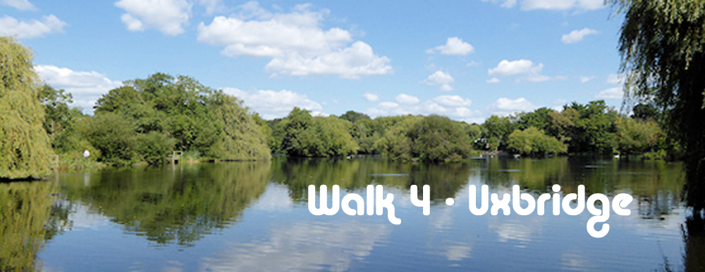
Walk No 4 - A Circular Walk from Uxbridge at the Western End of the Piccadilly and Metropolitan Lines
|
Distance |
10 km (6 miles) |
|
Underfoot |
Mostly paved surfaces. Some riverside paths |
|
Outward Journey |
Piccadilly or Metropolitan Line to Uxbridge (about 40 - 50 minutes from Central London) |
|
Return |
By outward route |
|
Points of Interest |
Grand Union Canal, Little Britain Lake, River Colne |
|
Refreshments |
Cafes and pubs in Uxbridge. Also can-side pubs |
|
Public Toilets |
At Uxbridge Station |
|
Shortening the Walk |
No options |
What to Expect From This Walk
This is a lovely walk beside attractive waterways. Once clear of the town centre, you will be walking entirely beside canals and rivers, either along towpaths or through riverside woods. In January and February look out for snowdrops near the river bank. You will see longboats, ducks, geese and swans and the occasional dog walker. Look out for cyclists on the canal section: many come up behind almost silently without the warning of a "ding" on their bell..You can avoid 1 km of road walking when leaving Uxbridge town centre by taking the no. 3 bus to Iver to the bridge over the Grand Union Canal, where the waterside section commences. Stop N is adjacent to the station and the bus runs every 20 minutes on weekdays, but less frequently at weekends.Uxbridge is a terminus for both the Piccadilly Line and the Metropolitan Line. Arriving by the latter is quicker. To shorten the journey even more, you can take the Jubilee Line out of Central London and change to the Metropolitan Line at Finchley Road.
Route Directions
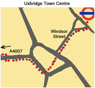
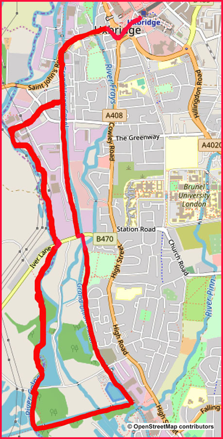
1. Leave the station and cross the street ahead of you. Enter Windsor Street and walk down to a large roundabout. Cross at the pedestrian lights and pass to the left of a building (Capital Court). Use the next two sets of lights to reach the opposite side of the roundabout. Turn right along the footpath and then left into New Windsor Street, which is signposted A4007 Uxbridge Industrial Estate. After 100m you arrive at a humpback bridge over Fray’s River. Cross to the right-hand footway at the pedestrian crossing. After another 400m you reach a bridge over the Grand Union Canal.
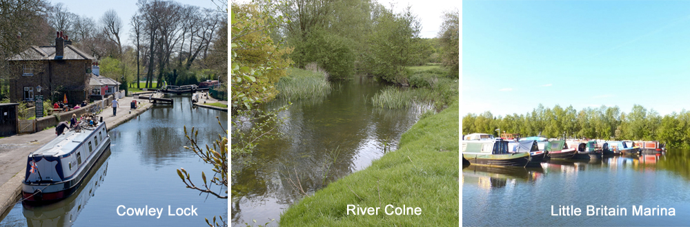
2. Cross the bridge and turn right to descend to the towpath. Turn right again and follow the towpath back under the bridge. Continue south along the tow-path. After 1.4 km, follow the towpath as it crosses to the opposite bank using a road bridge. Almost immediately, you reach Cowley Lock. Continue along the left-hand side of the canal for another 1.5 km. After going under a road bridge you will see the Packet Boat Marina on your right. Shortly afterwards, you come to a footbridge with a sign for the Slough Arm of the canal. This is the Cowley Peachey Junction. Turn right over the bridge to go ahead (west) alongside this new stretch of waterway.
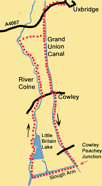
3. After 750m you come to a metal footbridge signposted London Loop and Hillingdon Trail. Go up the path on the left and then turn right across the bridge to leave the Slough Arm. From the bridge you can see (and hear) the M25 in the distance. You are now walking north, back towards Uxbridge. The path winds among trees and after 300m reaches Little Britain Lake. 30m further on, cross a footbridge on your left. Turn right, still following the London Loop. You are now walking along the left bank of the River Colne. This is a delightful stretch of river bank through woodland. When you reach a road, turn right and cross to the other side of the river.
4. Turn left, still following the London Loop, with the river now on your left and a high metal fence on your right. Continue for another 1.5 km until the path turns away from the river. It passes between some houses and then becomes a road. At a crossing road, go straight ahead into Culvert Lane and follow it until it reaches the Grand Union Canal. You are now back on your outward route. Turn left to reach the A4007, where there are two pubs, The General Eliott on the left and The Dolphin on the other side of the bridge. Cross the bridge and follow the outward route back to Uxbridge Station.
Information on the Things You Will See
Uxbridge began as settlement on the River Colne. Until the 19th century the prosperity of the town depended on its corn market and its importance as a flour milling centre, with thirteen mills along the Colne and Fray’s rivers. The 20th century saw rapid change, due to the extension of the Metropolitan Railway to Uxbridge in 1904. In 1918 the Royal Flying Corps moved into Hillingdon House, from where the Battle of Britain was directed.
The Grand Union Canal is the longest canal in the UK and runs for 220 km (137 miles) from London to Birmingham. It is the result of the amalgamation of several independent waterways, from 1894 to 1929. It is a broad canal, so called because its locks are wide enough to accommodate two narrowboats side by side or one wide-beam barge.
The River Colne rises in Hertfordshire and flows south to join the Thames at Staines. The section in this walk forms the boundary between Buckinghamshire and Greater London. Digging for gravel and clay along its lower course south of Rickmansworth has created a long chain of pits which have flooded to become lakes. These are habitats for wildlife and are protected as nature reserves.

