Walk No 10 – From West Ruislip, at the western end of the Central Line, to Northwood Hills
|
Distance |
7 km (4.5 miles) |
|
Underfoot |
Mostly paved surfaces. Some country paths |
|
Outward Journey |
By Central Line to West ruislip- about 35 minutes from Central London |
|
Return |
By Metropolitan Line from Northwood Hills |
|
Points of Interest |
Olympic Park. Victoria Park, Regent's Canal |
|
Refreshments |
Lakeside Cafe and waters Edge Pub at Ruislip Lido |
Public Toilets |
West Ruislip Station. Ruislip Lido |
Shortening the Walk |
Catch an H13 bus from the lido to Pinner or Ruislip Stations |

What To Expect From This Walk
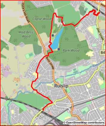
Within a short distance of leaving West Ruislip Station this walk enters quiet countryside and crosses the River Pinn to follow a series of paths behind houses and schools. Later, the walk goes through woodland to reach Ruislip Lido, with its artificial beach, café and pub. The route continues north through open countryside and then leads into Ruislip Woods. Towards the end of the walk, you climb up Haste Hill before reaching Northwood Hills Station.
Route Directions

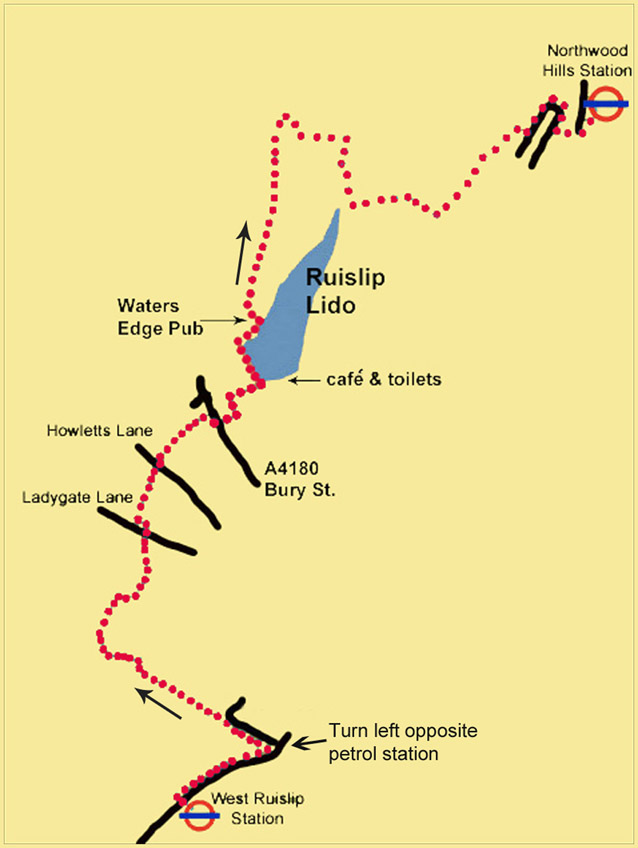
1. Use the pedestrian lights outside West Ruislip Station to cross to the opposite footway of the B466 (Ickenham Road). Turn right for 250m and then turn left opposite a petrol station into a cul-de-sac, by a sign for Ruislip Golf Centre. Go ahead
past a metal barrier on an asphalt cycle and pedestrian track. Where the asphalt path turns right, take a semi-surfaced footpath on the left, signposted R145, going through a kissing gate. Stay on this path, following the white arrows which mark the Hillingdon Trail (HT) and ignoring signs to the footpaths R146 and R147. Just after a path comes in diagonally from behind, follow the HT sign left across a footbridge over the River Pinn and walk into a field. About half-way up the field, go through a gap in the hedge on your left, where a stile and a waymark (HT) are just visible, and turn right on an enclosed path. Walk to the end of this path and reach the gates of Old Clack Farm on your right, with a wall ahead.
2. Climb over the stile in the right-hand corner of the wall and go down the right-hand side of a field. Turn right at a Hillingdon Trail signpost and cross a footbridge. Go through a gate and turn left to walk behind houses and a school. Turn left into Ladygate Lane, walk for 100m, turn right, signed HT, still continuing in the same direction as previously. Continue to Wheelers Drive, which leads into Wallington Close. Keep walking in the same direction and enter a footpath again.
3. Cross Howletts Lane and continue ahead to the right of some shops. This section is a grassy strip between houses on the left and trees on the right. After 300m go straight ahead across an open grassy space to reach Bury Street (the A4180). Turn right and cross the road, just after a bus stop. Go past a vehicle barrier onto a woodland track. At the first crossing track, turn left and follow this path as it veers right to follow a fence until you reach the metal gate to Ruislip Lido. Go through the gate and enter the Lido. You should turn right at this point if you wish to visit the beach and the Lakeside Café.
4. To continue, go straight ahead with the water on your right. At the far corner of the lake, turn right and pass a children’s play area. Just before the Waters Edge pub, turn left to reach a road. To your right you will see two car park entrances, with a gate between them. Go through the gate signposted HT and Footpath R59 and continue ahead on the clear path. At the first wooden fingerpost carry straight on.
5. The path rises between trees and continues in the same direction. About 1 km from the gate, a path comes in from the right. Ignore this and carry straight on. A little further on, there is a fork where you can see a pond ahead. Take the right-hand path, and cross over a footbridge and a stile. Turn right on Footpath 37, which goes along the edge of some trees, with a golf course on your left. Emerge from the trees facing the golf course but do not take the path ahead. Instead, turn sharp right past an old concrete bunker and follow a clear path through trees, with a fence on your right.

6. The path turns left here and there is no longer any cover between you and the golf course. After 200m, the path makes a sharp right turn and follows the line of trees. You reach a point where you can see the tracks of a miniature railway through a black metal fence on your right. Continue beside the fence for another 100m to a junction of paths. You then turn left on a footpath and walk uphill through the wood.
7. At the top of the hill, turn left and go through the first metal gate. Continue on a good path and ignore any options to turn to the left or the right. The view opens up over to your left. After about 600m the path becomes narrower and then descends through a meadow to reach a sports field. Turn right here and take the track which leads between houses to bring you out onto a residential road (Highland Road). Turn left and walk around two right-hand bends to find another footpath on your left, which leads you out to the main road near Northwood Hills Station.
Information on Things You Will See
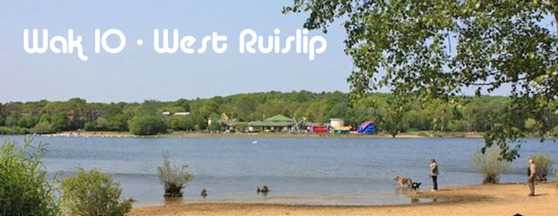
Ruislip Lido is a reservoir with an artificial beach. It was built as a feeder reservoir for the Grand Union Canal which is located several miles to the west. The Grand Junction Canal Company, as it was then called, purchased about 90 acres of land and the valley that the land covered was then dammed and flooded.The reservoir was opened on 5 December 1811 but the link to the canal did not fulfil its intended purpose, since the water became polluted by the land and was eventually stopped as a feeder in 1851. From 1950 - 1980 the Lido was in its heyday as a water-based recreation facility. The lake received thousands of visitors each summer, but in the 1970s a large increase in admission charges meant that people stopped coming and the Lido fell into a state of disrepair. It has only recently been returned to public use for boating and swimming, thanks to a project set up by the London Borough of Hillingdon. Surrounded by Ruislip Woods, London's First National Nature Reserve, the Lido remains a pleasant place to walk. On several occasions it has been used as a film set, notably for the sinking of the Titanic in A Night to Remember (1958) and in Cliff Richard’s film The Young Ones (1961).
Ruislip Lido Railway The narrow gauge railway was opened in 1945. It is still running today, manned by volunteers, and has been lengthened considerably, a second station and platform having been added near the Water's Edge pub. It runs about two thirds of the distance around the reservoir.
Northwood Hills The name "Northwood" apparently comes from "northwode" meaning the northern wood. It is an elevated urban area in the London Borough of Hillingdon and adjoins Ruislip Woods Nature Reserve. It also has a northern border with Hertfordshire. It is reputedly the location used for filming the 1970s BBC TV series "The Good Life".


