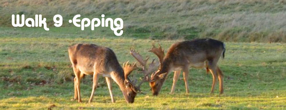
Walk No 9 - From Epping, at the Eastern End of the Central Line, through Epping Forest to Chingford
|
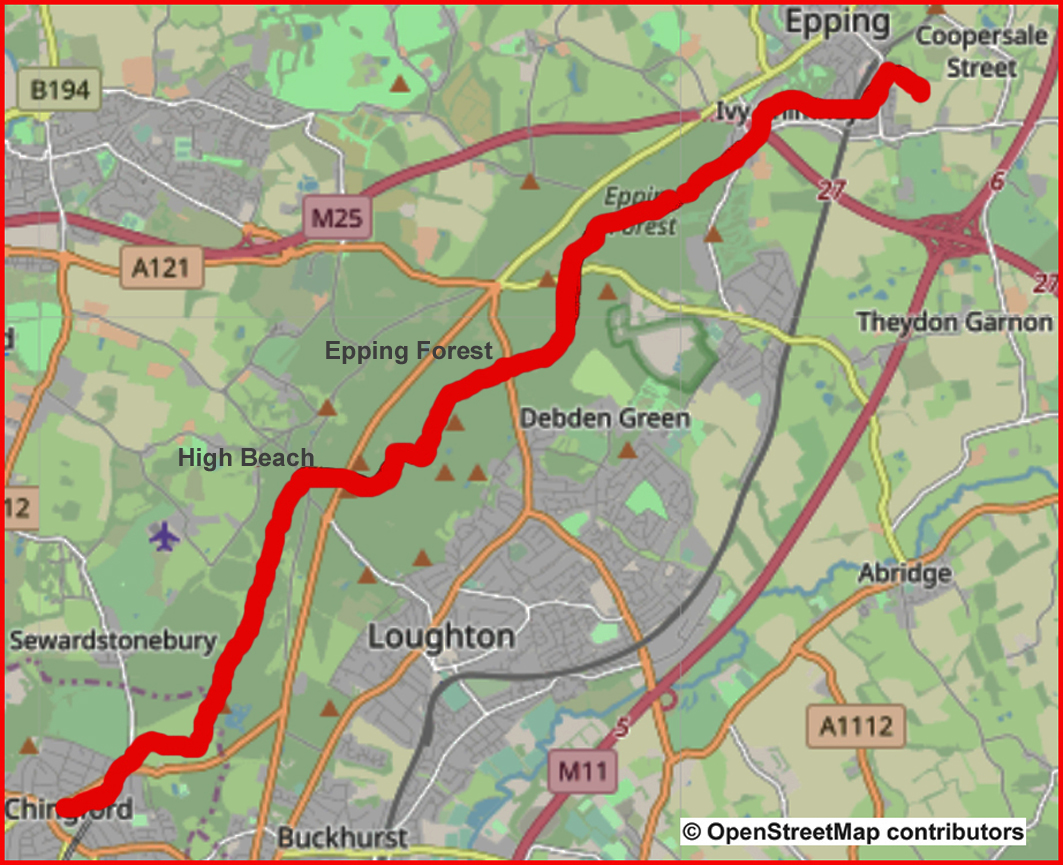
Distance |
15 km (9.5 miles) |
|
Underfoot |
Mostly woodland tracks |
|
Outward Journey |
By Central Line to Epping - about 45 minutes from Central London |
|
Return |
Overground from Chingford . (Connects with the Victoria Line at Walthamstow Central) |
|
Points of Interest |
Epping Forest, High Beach, Queen Elizabeth's Hunting Lodge |
|
Refreshments |
Two pubs en route. Refreshment kisk and cafe at High Beach, Butler's retreat cafe near the end |
|
Public Toilets |
At Eping Underground station and High Beach |
|
Shortening the Walk |
Epping Forest is poorly served by public transport. You could arrange for a taxi to meet you at High Beach (Kings Oak Pub) after 12 km. |
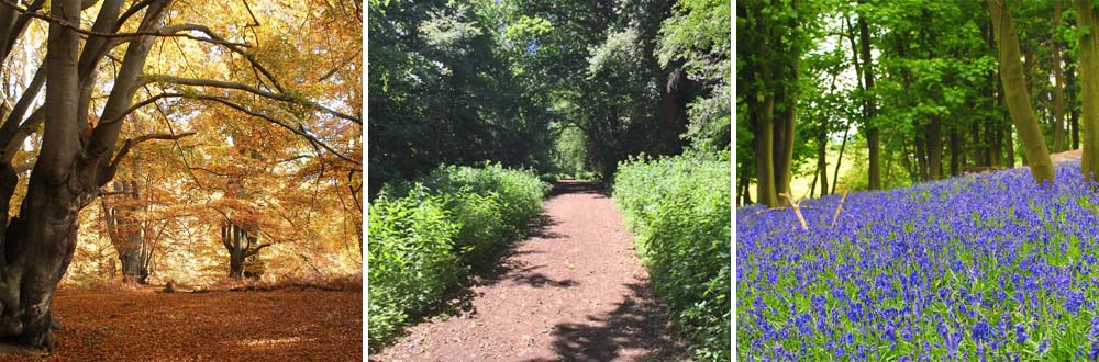
Photos of Epping Forest Through the Seasons
What To Expect From this Walk
This is a walk designed to show off the best of Epping Forest. It traverses the forest from north to south on paths which are accessible and easy to follow. The forest lies to the east of London on a ridge between the River Lea and the River Roding. It is an area of ancient woodland and a former royal forest, now managed by the City of London Corporation. It covers an area of about 6,000 acres and stretches between Epping in the north and Forest Gate in the south. It is approximately 19 km long but no more than 4 km wide from east to west. The age of the forest and the range of habitats which it contains make it a valuable area for wildlife. This walk shows off the many different aspects of Epping Forest from deep woodland and forest glades to open pastures and grassy meadows. It traverses the forest from north to south.
Route Directions
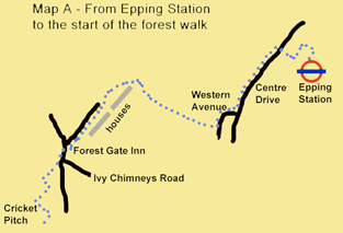
1. Epping Station to the forest (Map A) Turn right out of the station. On the opposite side of the road you will see the entrance to the station car park. Cross over and take the footpath which runs between fences down the right-hand side of the car park. Follow this enclosed path as it turns left and then right. Ascend a flight of steps to reach a residential road (Centre Drive). Turn left and walk for 300m. Just before a small open area of grass, turn right into Western Avenue, which swings to the left. A wide view opens up before you, including a sight of the M25 motorway. Turn right onto a public bridleway at a concrete fingerpost.
2. Follow this path uphill, ignoring a waymarked path to the right and other side paths. You come to an open area of grass. Pass a wooden bench at the top and follow the path to cross a surfaced drive. Turn left to follow an unsurfaced track (Bell Common) with houses on your left. Join a surfaced road coming in from the right. Continue in the same direction along this road until you reach a junction by the Forest Gate Inn. Turn left here, along Theydon Road. When you reach the junction with Ivy Chimneys Road coming in from the left, cross Theydon Road towards the driveway of a house. As you face the drive-way gate, look for a narrow path to your left, at the entrance to the drive, by a lamp post.
3. Follow this path diagonally into the trees until you emerge onto an open grassy area. You are now right above the M25, which runs in a tunnel below you. Cross the grass and turn right on a path coming in from the left. You will see a cricket pitch ahead but before you reach it, turn left onto a path which leads into the trees and up to a ‘roundabout’ of paths, where you continue in the same direction on a broad forest track, soon passing a yellow waymark arrow.

4. To High Beach (Map B) Follow this waymarked track for 2 km, ignoring all turnings to left and right. (After 1.5 km look out for a sign to your right for a short detour to the site of Ambresbury Banks ancient earthworks.) You then reach a road (the B172). Cross the road to the Jack’s Hill information board, and take the waymarked track through a vehicle barrier, slightly to the right beyond the board. After 500m ignore a small yellow waymarked path to the left. 200m later (700m from Jack’s Hill) turn right at a junction onto an unmarked track. This track broadens as it descends and then climbs to reach a small car park (Broadstrood). Stay on the path to the left of the car park to reach the A121.
5. Cross the road with care and take the track opposite, past a vehicle barrier. After a level start the track begins to descend. At the bottom of the hill it swings to the right, then climbs in a series of stages before a final steeper stretch. The track then levels out. After about 200m, at the first junction, turn right to join a broad track, by a bracken-filled triangle. You follow this track to reach a car park on Epping New Road (the A104). Cross over with care and go through a gate to take the track opposite, which swings to the left. Follow this track, ignoring small paths to the left and right, until you reach a T-junction. Turn right here and then continue straight ahead for 250m to reach the road at High Beach, with a large car park over to your left. Cross the road and go left past a refreshment kiosk, to walk along the open grass area with good views to the north. To your left is the entrance to the Epping Forest Visitor Centre. Cross over here for the public toilets and the Kings Oak café and pub.
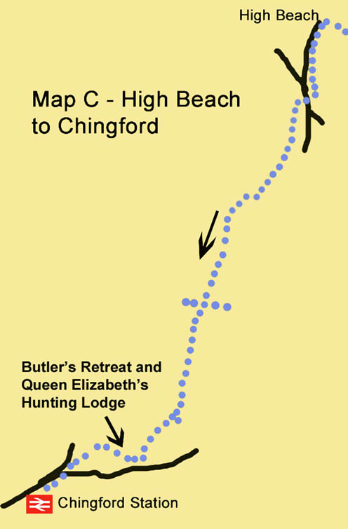
6. To Chingford (Map C) Walk along the road past the Kings Oak. Pass a large pond on the right, and a wooden fence on your left. Where the fence ends, just after you have passed the entrance to a house, take the narrow path to the left which leads into the trees by a small brick building. The path runs parallel to, and never far from, the road. It eventually leads you back to join the road by a vehicle barrier, where a wider path comes in from the left. (A short detour here down the road to the left leads to a popular roadside café.)
7. Cross the road, and take the track opposite, but slightly to the right, past another vehicle barrier. You follow this track for more than 3 km, all the way to Chingford, initially following the yellow and orange waymark arrows. After 800m the path follows a dog-leg right and left. After another 500m, it continues ahead across a junction with other tracks. Later, ignore a yellow arrow pointing to the right and continue to follow the orange arrow pointing straight ahead. When you eventually reach a point where the main track swings left, take the broad grassy path straight ahead. At a clearing where a path comes in from the left, go straight on and slightly uphill towards the white weatherboarded building just visible ahead. This is Butler’s Retreat café.
8. Just before an impressive restored drinking fountain, follow the fingerpost sign right towards Queen Elizabeth’s Hunting Lodge. Turn right when you reach the hedge enclosing the Lodge car park and go down the grassy slope on a waymarked path towards a small bridge. Do not cross the bridge but turn left along a clear path, which leads you straight to Chingford. When you reach the main road, cross at the traffic island and turn right. Chingford Overground Station, with trains to Liverpool Street, is on your left, just beyond the bus station. You can change to the Victoria Line at Walthamstow Central.
Information on Things You Will See
High Beach was the first British venue for motorcycle speedway and opened in February 1928. The track, which was behind The Kings Oak public house, drew large crowds. It was closed when a swimming pool was added to the pub's grounds after the Second World War. The remains of the track are still visible, in the grounds of the Epping Forest Field Centre behind the King's Oak.
Queen Elizabeth's Hunting Lodge was once known as the Great Standing. In Tudor times Henry VIII often hunted in the forest and in 1543 he commissioned a building from which to view the chase at Chingford. The building was renovated in 1589 for Queen Elizabeth I. The Lodge is open to visitors from Tuesday to Sunday all year round.

